Code: 10524
Dimensions:
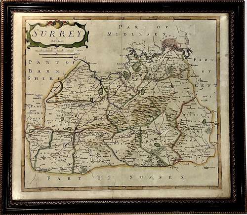
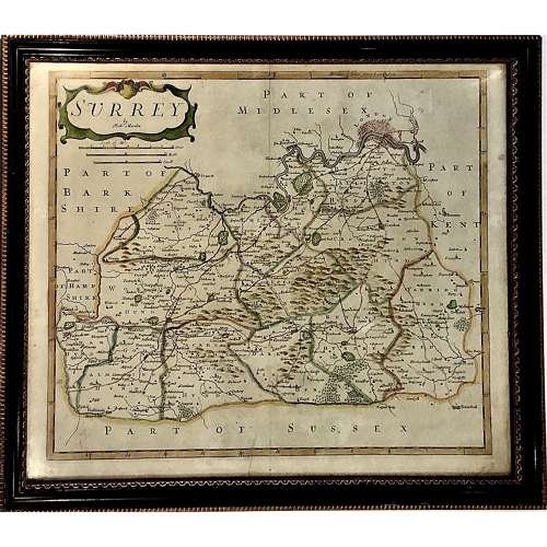
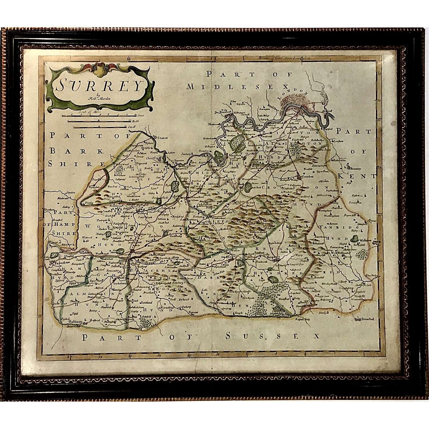
Robert Morden (c. 1650–1703)
"Surrey"
Copper-plate engraving with original hand-colouring
Originally published 1695 but probably
an 18th Century edition
38.5 cm x 46 cm (Paper size)
44 cm x 51 cm (Framed)
An antique map by Robert Morden (c. 1650–1703) of the English county of Surrey. The print here probably taken from the third edition of William Camden’s “Britannia: or a chorographical description of Great Britain and Ireland” published in 1753.
Beautifully presented, framed and glazed in an antique Hogarth style frame. Hand-colouring attractive and strong. Usual atlas fold to the centre.