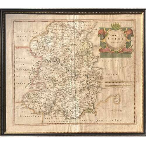
Code: 11718
Robert Morden (c. 1650–1703)
"Shropshire"
Copper-plate engraving with original hand-colouring
Originally published 1695
Measures:-
40 cm x 46 cm (Paper size)
43 cm x 49 cm (Framed)
An antique map by Robert Morden (c. 1650–1703) of the English county of Shropshire. This map was first published in 1695 but the print here is probably around 250 years old and likely removed from a volume of the 3rd Edition of William Camden’s “Britannia: Or a Chorographical Description of Great Britain and Ireland”, published in 1753.
Very well presented, framed and glazed in a Hogarth style frame. The hand-colouring attractive and strong. Usual atlas fold to the centre. Attractive toning to the paper, as befitting an antique map 250+ years-old. Unexamined out of frame, but lightening towards the bottom of the central fold, possibly indicating an old paper strengthening that area of the crease.
All-in-all a very pleasing copy of this sought after county map.